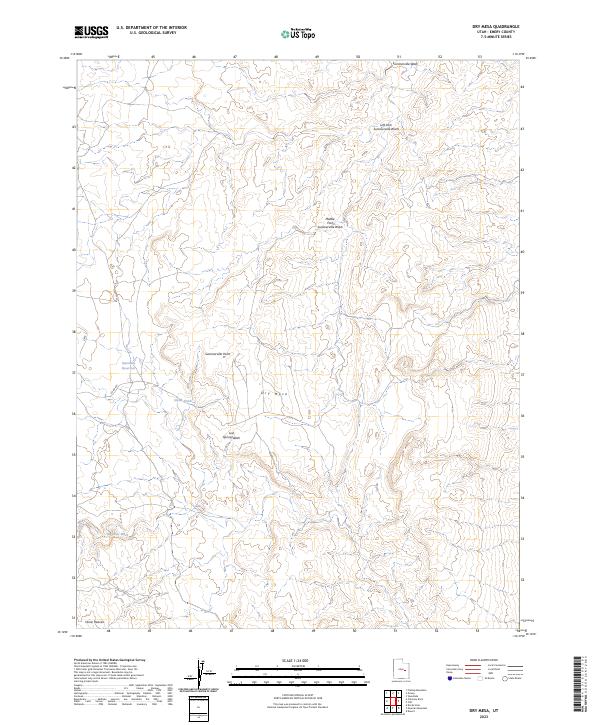
2023 Map of Dry Mesa
USGS Topo · Published 2023About this map
Dry Mesa dominates the landscape of this Emery County region, characterized by its complex network of seasonal drainages and high desert plateaus. The land is carved by the Summerville Wash system, including its Left Fork and Middle Fork, which delineate the local topography. Human infrastructure is focused on water management and transit, with Saleratus Reservoir and the smaller Smith Pond providing essential collection points for the scarce precipitation in an arid environment. A single primary road, Co RD 401, traverses the western portion of the map, providing the main artery through the area. From the northern prominence at Summerville Point to the southern reach of Horse Heaven, the map documents a terrain defined by erosional features like Big Hole Wash and Lost Spring Wash, reflecting the geological character of the San Rafael Swell area.
Find a feature on this map
11 named features on this map. Tap any name to fly to it.
Don’t see what you’re looking for? This feature index may not catch every label — zoom into the map to look around manually.
Map Details
Editions of this 2023 Dry Mesa Map
This is the sole edition of this map. No revisions or reprints were ever made.
Other maps of this area

1886 · Price River
USGS Topo · 1:250,000

1896 · Price River
USGS Topo · 1:250,000

1948 · Woodside
USGS Topo · 1:62,500

1949 · Woodside
USGS Topo · 1:62,500

1950 · Woodside
USGS Topo · 1:62,500

1953 · Red Plateau SE
USGS Topo · 1:24,000

1953 · Beckwith Peak SW
USGS Topo · 1:24,000

1956 · Price
USGS Topo · 1:250,000

1960 · Price
USGS Topo · 1:250,000

1962 · Price
USGS Topo · 1:250,000