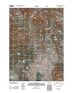
2011 Map of Dry Prairie
USGS Topo · Published 2011About this map
Dry Prairie and its surrounding high-desert landscape in Klamath County are defined by a complex network of cattle ranches and seasonal water sources. The 2011 survey reveals an environment where survival and industry center on named catchments like O'Connor Reservoir, Willow Flat Reservoir, and Dry Prairie Number One Pond. Settled activity is concentrated at the Wilson Ranch and Vinson Ranch, connected by forest routes and the prominent Keno Springs Rd. The terrain transitions from the open stretches of Yellow Jacket Flat and Mineral Prairie to the distinct verticality of Gerber Rim and James Butte. This cartographic record is particularly useful for identifying the specific locations of remote water features such as Nuthatch Springs and Mineral Spring, which historically supported livestock and wildlife in the arid Hungry Hollow region.
Find a feature on this map
35 named features on this map. Tap any name to fly to it.
Don’t see what you’re looking for? This feature index may not catch every label — zoom into the map to look around manually.
Map Details
Editions of this 2011 Dry Prairie Map
This is the sole edition of this map. No revisions or reprints were ever made.
Other maps of this area

1889 · Klamath
USGS Topo · 1:250,000

1894 · Klamath
USGS Topo · 1:250,000

1955 · Klamath Falls
USGS Topo · 1:250,000

1957 · Malin
USGS Topo · 1:62,500

1958 · Klamath Falls
USGS Topo · 1:250,000

1960 · Gerber Reservoir
USGS Topo · 1:62,500

1960 · Bly
USGS Topo · 1:62,500

1960 · Beatty
USGS Topo · 1:62,500
1988 · Gerber Reservoir
USGS Topo · 1:24,000
1988 · Yainax Butte
USGS Topo · 1:24,000