
2015 Map of Dry Tortugas
USGS Topo · Published 2015About this map
Dry Tortugas National Park dominates this maritime survey, covering a remote section of the Atlantic Ocean at the western edge of the Florida Keys. The map primarily depicts the marine environment and jurisdictional boundaries, including the line for Monroe Co and the state of Florida. Of particular interest to maritime researchers is the labeling of Dry Tortugas Fry, a specific underwater feature or fishing area near the southeastern corner of the quadrangle. Because this is a nautical and park-focused sheet, it emphasizes the preservation boundaries and the open sea rather than terrestrial development, illustrating the protected status of these waters.
Find a feature on this map
5 named features on this map. Tap any name to fly to it.
Don’t see what you’re looking for? This feature index may not catch every label — zoom into the map to look around manually.
Map Details
Editions of this 2015 Dry Tortugas Map
This is the sole edition of this map. No revisions or reprints were ever made.
Other maps of this area
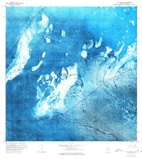
1971 · Dry Tortugas
USGS Topo · 1:24,000

1983 · Dry Tortugas
USGS Topo · 1:100,000

1989 · Dry Tortugas
USGS Topo · 1:250,000
2012 · Dry Tortugas
USGS Topo · 1:24,000
2012 · Dry Tortugas OE S
USGS Topo · 1:24,000
2012 · Dry Tortugas OE E
USGS Topo · 1:24,000
2012 · Dry Tortugas OE SE
USGS Topo · 1:24,000
2015 · Dry Tortugas OE SE
USGS Topo · 1:24,000
2015 · Dry Tortugas OE E
USGS Topo · 1:24,000
2015 · Dry Tortugas OE S
USGS Topo · 1:24,000