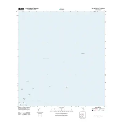
2012 Map of Dry Tortugas OE E
USGS Topo · Published 2012About this map
Fort Jefferson stands as the primary landmark on Garden Key in this maritime survey of the eastern Dry Tortugas group. The map delineates a remote island chain and its surrounding coral shoals within the Gulf of Mexico. Beyond the masonry fortifications of the fort, the map identifies several significant keys including Hospital Key, Middle Key, and East Key. These low-lying features are surrounded by hazardous navigational obstacles such as Pulaski Shoal and the Middle Ground. The deep-water Southeast Channel provides a corridor through the reefs, leading past Long Key and Bush Key Shoal. This documentation of the shifting sandy keys and permanent harbor structures reflects the ongoing environmental and structural maintenance of this maritime outpost in the early 21st century.
Find a feature on this map
15 named features on this map. Tap any name to fly to it.
Don’t see what you’re looking for? This feature index may not catch every label — zoom into the map to look around manually.
Map Details
Editions of this 2012 Dry Tortugas OE E Map
This is the sole edition of this map. No revisions or reprints were ever made.
Other maps of this area
1971 · Dry Tortugas
USGS Topo · 1:24,000

1983 · Dry Tortugas
USGS Topo · 1:100,000

1989 · Dry Tortugas
USGS Topo · 1:250,000
2012 · Dry Tortugas
USGS Topo · 1:24,000
2012 · Dry Tortugas OE S
USGS Topo · 1:24,000
2012 · Dry Tortugas OE SE
USGS Topo · 1:24,000
2015 · Dry Tortugas OE SE
USGS Topo · 1:24,000
2015 · Dry Tortugas OE E
USGS Topo · 1:24,000
2015 · Dry Tortugas OE S
USGS Topo · 1:24,000

2015 · Dry Tortugas
USGS Topo · 1:24,000