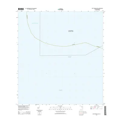
2015 Map of Dry Tortugas OE S
USGS Topo · Published 2015About this map
Atlantic Ocean waters dominate this 2015 survey, covering a remote maritime section of the Florida Keys. The map focuses on the submerged and open-water expanses within Dry Tortugas National Park, illustrating the protected marine environment at the far western end of the archipelago. As an offshore sheet (OE S), the primary information gain is the precise delineation of jurisdictional boundaries, including the Monroe Co and Florida state lines as they transition into federal waters. This chart serves as a modern record of the sea-based borders that define one of the most secluded national parks in the United States, providing a clear view of the maritime territory before reaching the open gulf.
Find a feature on this map
4 named features on this map. Tap any name to fly to it.
Don’t see what you’re looking for? This feature index may not catch every label — zoom into the map to look around manually.
Map Details
Editions of this 2015 Dry Tortugas OE S Map
This is the sole edition of this map. No revisions or reprints were ever made.
Other maps of this area
1971 · Dry Tortugas
USGS Topo · 1:24,000

1983 · Dry Tortugas
USGS Topo · 1:100,000

1989 · Dry Tortugas
USGS Topo · 1:250,000
2012 · Dry Tortugas
USGS Topo · 1:24,000
2012 · Dry Tortugas OE S
USGS Topo · 1:24,000
2012 · Dry Tortugas OE E
USGS Topo · 1:24,000
2012 · Dry Tortugas OE SE
USGS Topo · 1:24,000
2015 · Dry Tortugas OE SE
USGS Topo · 1:24,000
2015 · Dry Tortugas OE E
USGS Topo · 1:24,000

2015 · Dry Tortugas
USGS Topo · 1:24,000