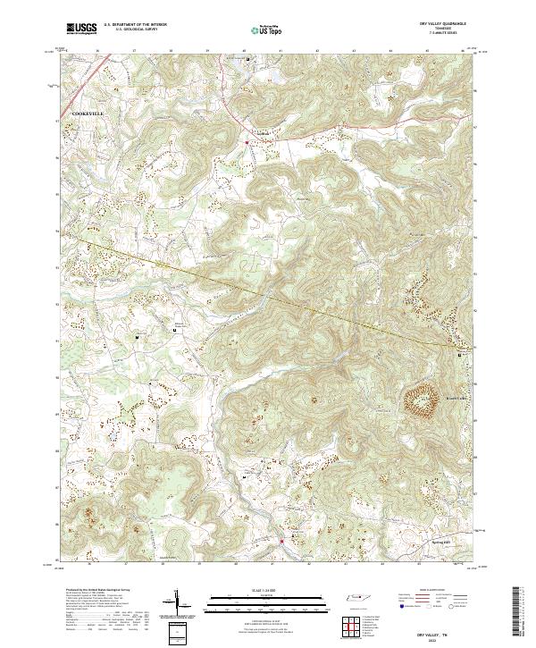
2022 Map of Dry Valley
USGS Topo · Published 2022About this map
The Putnam and White County boundary cuts across this landscape of high plateaus and deep coves, where the Falling Water River flows near the eastern edge of Cookeville. The terrain is defined by a series of distinct natural hollows and elevations, including Phifer Mtn, Burnett Mtn, and the expansive Dry Valley. Settlement patterns follow these geological features, with communities like Goffton and Board Valley situated near significant terrain changes.
Find a feature on this map
117 named features on this map. Tap any name to fly to it.
Don’t see what you’re looking for? This feature index may not catch every label — zoom into the map to look around manually.
Map Details
Editions of this 2022 Dry Valley Map
This is the sole edition of this map. No revisions or reprints were ever made.
Other maps of this area

1892 · Pikeville
USGS Topo · 1:125,000

1893 · Mc Minnville
USGS Topo · 1:125,000

1895 · Mc Minnville
USGS Topo · 1:125,000

1895 · Pikeville
USGS Topo · 1:125,000

1897 · Standingstone
USGS Topo · 1:125,000

1898 · Standingstone
USGS Topo · 1:125,000

1943 · Cookeville
USGS Topo · 1:100,000

1944 · Cookeville
USGS Topo · 1:100,000

1953 · Chattanooga
USGS Topo · 1:250,000

1953 · Cookeville East
USGS Topo · 1:24,000