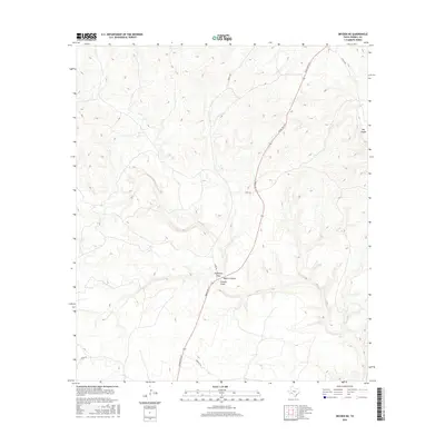
2016 Map of Dryden NE
USGS Topo · Published 2016About this map
Meyers Canyon and its associated drainage systems define the rugged topography of this West Texas landscape in the mid-2010s. The convergence of Eightmile Draw and Downie Draw near the center of the sheet highlights the natural catchment patterns that have shaped land use in Terrell County for generations. This arid terrain is navigated by a network of ranch-to-market infrastructure, most notably Ranch Rd 1217, which cuts a primary north-south path through the high desert. To the northeast, the deep indentation of Big Canyon further emphasizes the dramatic relief of the Trans-Pecos region. Secondary access is provided by several named rural routes, including Stavley Rd and James Rd, which serve the isolated ranching properties and livestock operations that characterize this sparsely populated corner of the state.
Find a feature on this map
10 named features on this map. Tap any name to fly to it.
Don’t see what you’re looking for? This feature index may not catch every label — zoom into the map to look around manually.
Map Details
Editions of this 2016 Dryden NE Map
This is the sole edition of this map. No revisions or reprints were ever made.
Other maps of this area

1928 · Sanderson
USGS Topo · 1:125,000

1954 · Fort Stockton
USGS Topo · 1:250,000

1954 · Sonora
USGS Topo · 1:250,000

1958 · Sonora
USGS Topo · 1:250,000

1958 · Fort Stockton
USGS Topo · 1:250,000

1968 · Dryden
USGS Topo · 1:24,000

1969 · Mofeta
USGS Topo · 1:24,000

1969 · Continental Ranch
USGS Topo · 1:24,000

1969 · Dryden NE
USGS Topo · 1:24,000

1969 · Dryden NW
USGS Topo · 1:24,000