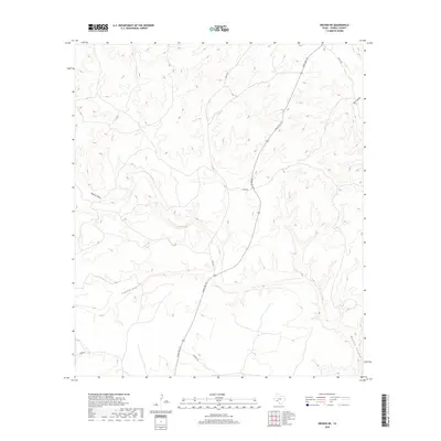
2019 Map of Dryden NE
USGS Topo · Published 2019About this map
Deep drainages and winding canyon systems define this portion of Terrell County, where the high desert landscape is carved by features like Downie Draw and Eightmile Draw. This 2019 survey documents a sparsely populated ranching environment centered around the path of Ranch Rd 1217. The terrain is characterized by dramatic elevation shifts as the land falls away into Big Canyon and Meyers Canyon, highlighting the complex limestone topography of the eastern Trans-Pecos. Local transportation is limited to a handful of gravel routes and ranch tracks, including Stanley Rd, Riggs Rd, and James Rd, which provide access to remote acreage and water sources. These named roads and draws are essential landmarks for understanding land ownership and navigation in a region where few permanent settlements exist, but long-established ranching interests maintain a presence.
Find a feature on this map
10 named features on this map. Tap any name to fly to it.
Don’t see what you’re looking for? This feature index may not catch every label — zoom into the map to look around manually.
Map Details
Editions of this 2019 Dryden NE Map
This is the sole edition of this map. No revisions or reprints were ever made.
Other maps of this area

1928 · Sanderson
USGS Topo · 1:125,000

1954 · Fort Stockton
USGS Topo · 1:250,000

1954 · Sonora
USGS Topo · 1:250,000

1958 · Sonora
USGS Topo · 1:250,000

1958 · Fort Stockton
USGS Topo · 1:250,000

1968 · Dryden
USGS Topo · 1:24,000

1969 · Mofeta
USGS Topo · 1:24,000

1969 · Continental Ranch
USGS Topo · 1:24,000

1969 · Dryden NE
USGS Topo · 1:24,000

1969 · Dryden NW
USGS Topo · 1:24,000