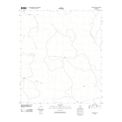
2010 Map of Dryden NW
USGS Topo · Published 2010About this map
Mitchell Ranch, Wood Ranch, and Odom Ranch define the human footprint across this dry landscape in Terrell County. The map documents a classic West Texas ranching environment where life and movement are dictated by the natural drainage systems of Downie Draw and Eightmile Draw. These ephemeral watercourses carve through the terrain, providing the primary geographic structure for the isolated homesteads and access routes like James Rd. The sparse road network, including the southern path of Odom Rd, illustrates the vast distances between established sites in this portion of the Trans-Pecos region. This 2010 survey provides a precise look at the rural infrastructure of the early 21st century, from the placement of individual ranch buildings to the subtle elevation changes that guide runoff toward the Pecos River basin beyond these borders.
Find a feature on this map
7 named features on this map. Tap any name to fly to it.
Don’t see what you’re looking for? This feature index may not catch every label — zoom into the map to look around manually.
Map Details
Editions of this 2010 Dryden NW Map
This is the sole edition of this map. No revisions or reprints were ever made.
Other maps of this area

1928 · Sanderson
USGS Topo · 1:125,000

1954 · Fort Stockton
USGS Topo · 1:250,000

1958 · Fort Stockton
USGS Topo · 1:250,000

1968 · Dryden
USGS Topo · 1:24,000

1969 · Sanderson SE
USGS Topo · 1:24,000

1969 · Big Canyon Ranch
USGS Topo · 1:24,000

1969 · Mofeta
USGS Topo · 1:24,000

1969 · Continental Ranch
USGS Topo · 1:24,000

1969 · Dryden NE
USGS Topo · 1:24,000

1969 · Dryden NW
USGS Topo · 1:24,000