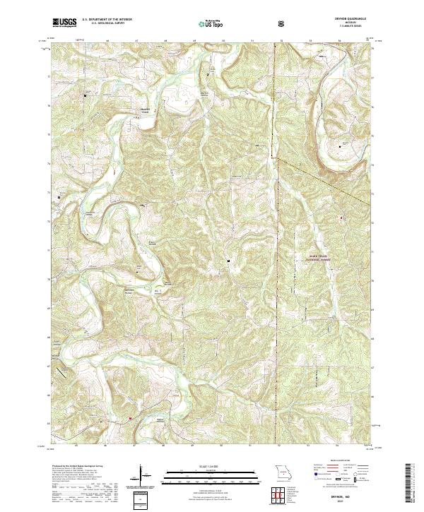
2021 Map of Drynob
USGS Topo · Published 2021About this map
The Osage Fork Gasconade River and the main channel of the Gasconade River define the winding drainage patterns of this Ozark landscape. Small communities and historical crossroads such as Abo and Drynob are dispersed throughout the area, connected by a network of state routes like State Hwy AC and local roads. Genealogists will find several family-named burial sites, including Similin Cem, Wilson Cem, and Wrinkle Cem, often situated near hollows like Murrell Hollow or Millstone Hollow. Much of the eastern portion of this territory is within the Mark Twain National Forest, while human landmarks like the Matzie Airport and water crossings at Harrill Ford and Hull Ford Bridge show how the local population has navigated the terrain. The map captures a mix of public timberlands and private agricultural plots typical of Laclede and Pulaski counties.
Find a feature on this map
59 named features on this map. Tap any name to fly to it.
Don’t see what you’re looking for? This feature index may not catch every label — zoom into the map to look around manually.
Map Details
Editions of this 2021 Drynob Map
This is the sole edition of this map. No revisions or reprints were ever made.
Other maps of this area

1933 · Stoutland
USGS Topo · 1:62,500

1938 · Stoutland
USGS Topo · 1:62,500

1941 · Lebanon
USGS Topo · 1:62,500

1943 · Richland
USGS Topo · 1:62,500

1943 · Lebanon
USGS Topo · 1:62,500

1943 · Drynob
USGS Topo · 1:62,500

1954 · Springfield
USGS Topo · 1:250,000

1954 · Drynob
USGS Topo · 1:62,500
1954 · Richland
USGS Topo · 1:62,500

1954 · Drew
USGS Topo · 1:24,000