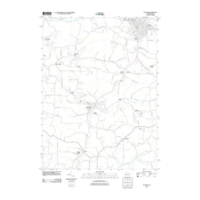
2010 Map of Du Bois
USGS Topo · Published 2010About this map
Du Bois and Sykesville anchor this map of west-central Pennsylvania, where the landscape is defined by the legacy of coal and rail. Numerous burial sites like Rumbarger Cemetery and Saint Michaels Cemetery testify to the area's ancestral depth, while the surrounding topography is carved by waterways such as Sandy Lick Creek and Stump Creek. Industrial connections are evident at rail nodes like East Du Bois Junction and C and M Junction, where tracks once serviced local operations near Eriton and Helvetia. Settlements like Rathmel and Soldier are linked by a network of backroads, including Big Run Prescottville Rd. The presence of the Helvetia Dam and Reynoldsville Storage Dam underscores the critical role of water management in supporting these communities and their local industries during the early twenty-first century.
Find a feature on this map
105 named features on this map. Tap any name to fly to it.
Don’t see what you’re looking for? This feature index may not catch every label — zoom into the map to look around manually.
Map Details
Editions of this 2010 Du Bois Map
This is the sole edition of this map. No revisions or reprints were ever made.
Other maps of this area

1903 · Curwensville
USGS Topo · 1:62,500

1906 · Punxsutawney
USGS Topo · 1:62,500

1922 · Du Bois
USGS Topo · 1:62,500

1924 · Du Bois
USGS Topo · 1:62,500

1929 · Penfield
USGS Topo · 1:62,500

1932 · Penfield
USGS Topo · 1:62,500

1939 · Curwensville
USGS Topo · 1:62,500

1939 · Punxsutawney
USGS Topo · 1:62,500

1942 · Curwensville
USGS Topo · 1:62,500

1942 · Punxsutawney
USGS Topo · 1:62,500