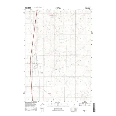
2017 Map of Dubois
USGS Topo · Published 2017About this map
Dubois serves as the primary hub of this eastern Idaho landscape, where the high desert terrain is defined by a grid of agricultural and transport routes. Modern infrastructure like the Dubois Municipal Airport sits just south of the town center, illustrating the area's role as a regional aviation and transit point. The flow of Beaver Cr cuts through the western portion of the map, paralleling the primary north-south corridors that have served travelers for decades.
Find a feature on this map
22 named features on this map. Tap any name to fly to it.
Don’t see what you’re looking for? This feature index may not catch every label — zoom into the map to look around manually.
Map Details
Editions of this 2017 Dubois Map
This is the sole edition of this map. No revisions or reprints were ever made.
Other maps of this area

1955 · Dubois
USGS Topo · 1:250,000

1957 · Paul Reservoir
USGS Topo · 1:62,500

1958 · Dubois
USGS Topo · 1:250,000

1964 · Dubois NW
USGS Topo · 1:24,000

1964 · Lone Butte
USGS Topo · 1:24,000

1964 · Dubois NE
USGS Topo · 1:24,000

1964 · Camas
USGS Topo · 1:24,000
1964 · Dubois SE
USGS Topo · 1:24,000

1964 · Cedar Butte SE
USGS Topo · 1:24,000

1972 · Spencer South
USGS Topo · 1:24,000