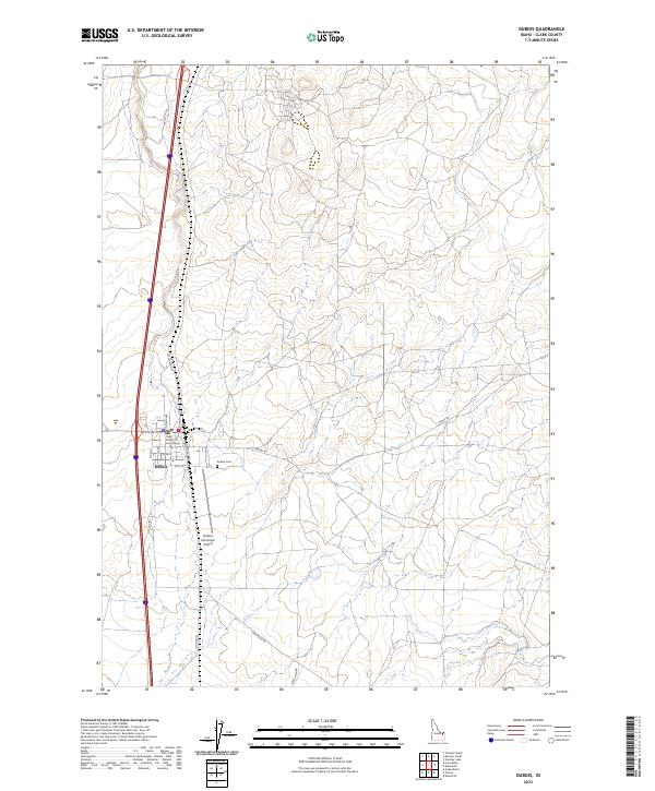
2023 Map of Dubois
USGS Topo · Published 2023About this map
Dubois serves as the focal point of this high-altitude landscape, situated where the high desert terrain of the Snake River Plain begins its gradual ascent. The settlement's grid is clearly defined, with N Reynolds St serving as a primary corridor through the community. To the east and west, the terrain is marked by the braided drainage patterns of the high country, most notably along the course of Beaver Creek. The map documents a critical transportation junction, where modern infrastructure follows historical paths through Clark County. The surrounding sections reveal the transition from organized settlement to the expansive open lands characteristic of this portion of Idaho.
Find a feature on this map
3 named features on this map. Tap any name to fly to it.
Don’t see what you’re looking for? This feature index may not catch every label — zoom into the map to look around manually.
Map Details
Editions of this 2023 Dubois Map
This is the sole edition of this map. No revisions or reprints were ever made.
Other maps of this area

1955 · Dubois
USGS Topo · 1:250,000

1957 · Paul Reservoir
USGS Topo · 1:62,500

1958 · Dubois
USGS Topo · 1:250,000

1964 · Dubois NW
USGS Topo · 1:24,000

1964 · Lone Butte
USGS Topo · 1:24,000

1964 · Dubois NE
USGS Topo · 1:24,000

1964 · Camas
USGS Topo · 1:24,000
1964 · Dubois SE
USGS Topo · 1:24,000

1964 · Cedar Butte SE
USGS Topo · 1:24,000

1972 · Spencer South
USGS Topo · 1:24,000