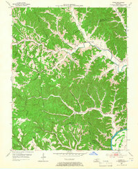
1953 Map of Dubre
USGS Topo · Published 1966About this map
Marrowbone Creek and Mud Camp Creek anchor the landscape of this southern Kentucky region, where the borders of Metcalfe, Cumberland, and Monroe counties converge. In the early 1950s, the area maintained a dense network of local institutions, with small rural schools such as Pitman Sch and Leatherwood Sch serving dispersed agricultural communities. The settlement of Dubre sits at a crossroads near the center of the map, while Willow Shade occupies the northwestern corner, connected by the winding route of KY 90. The terrain is characterized by prominent ridges, including Kesler Ridge and Hickory Ridge, which separate the numerous branch and hollow drainage systems. To the southeast, the Cumberland River forms a wide meander at Salt Lick Bend, featuring Cloyds Landing Island, marking the lowest elevation and a vital natural landmark for the county line.
Find a feature on this map
57 named features on this map. Tap any name to fly to it.
Don’t see what you’re looking for? This feature index may not catch every label — zoom into the map to look around manually.
Map Details
Editions of this 1953 Dubre Map
2 editions found
Other maps of this area

1924 · Lillydale
USGS Topo · 1:62,500

1926 · Lillydale
USGS Topo · 1:62,500

1929 · Lillydale
USGS Topo · 1:62,500

1929 · Tompkinsville
USGS Topo · 1:62,500

1953 · Sulphur Lick
USGS Topo · 1:24,000

1953 · Breeding
USGS Topo · 1:24,000

1953 · Waterview
USGS Topo · 1:24,000

1953 · Edmonton
USGS Topo · 1:24,000

1953 · Summer Shade
USGS Topo · 1:24,000

1953 · Dubre
USGS Topo · 1:24,000