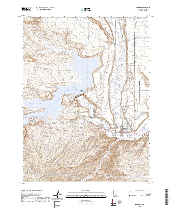
2023 Map of Duchesne
USGS Topo · Published 2023About this map
The Duchesne townsite sits at the confluence of the Strawberry River and the Duchesne River, serving as a central hub for the surrounding plateau and canyon lands. This high-desert landscape is defined by its elaborate water management systems, including the Pioneer Canal, City Canal, and Murray White Canal, which divert water from the river valleys to support the arid benches. To the northwest, the Starvation Reservoir dominates the terrain, its waters reaching into Rabbit Gulch and Saleratus Wash.
Find a feature on this map
54 named features on this map. Tap any name to fly to it.
Don’t see what you’re looking for? This feature index may not catch every label — zoom into the map to look around manually.
Map Details
Editions of this 2023 Duchesne Map
This is the sole edition of this map. No revisions or reprints were ever made.
Other maps of this area

1885 · Uinta
USGS Topo · 1:250,000

1939 · Duchesne
USGS Topo · 1:125,000

1954 · Salt Lake City
USGS Topo · 1:250,000

1958 · Salt Lake City
USGS Topo · 1:250,000

1960 · Salt Lake City
USGS Topo · 1:250,000
1962 · Buck Knoll
USGS Topo · 1:24,000

1962 · Blacktail Mtn
USGS Topo · 1:24,000

1962 · Rabbit Gulch
USGS Topo · 1:24,000
1964 · Duchesne SE
USGS Topo · 1:24,000
1964 · Duchesne SW
USGS Topo · 1:24,000