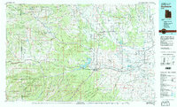
1982 Map of Duchesne
USGS Topo · Published 1987About this map
Starvation Lake State Beach and the massive Starvation Reservoir dominate the center of this 1980s landscape, where the high desert plateau of the Uintah and Ouray Indian Reservation meets the foothills of the Uinta National Forest. The geography is defined by the descent of the Duchesne River and its many tributaries, including the Strawberry River and Lake Fork River, which carve through deep gulches and across broad benches like Blue Bench. Local life centers around a network of high-country settlements such as Tabiona, Altamont, and Myton. This map captures the region's complex water management system, showing numerous canals and reservoirs like Red Creek Reservoir and Lake Boreham that sustain the arid valley floor below the looming peaks of Tabby Mountain and Blacktail Mountain.
Find a feature on this map
65 named features on this map. Tap any name to fly to it.
Don’t see what you’re looking for? This feature index may not catch every label — zoom into the map to look around manually.
Map Details
Editions of this 1982 Duchesne Map
This is the sole edition of this map. No revisions or reprints were ever made.
Other maps of this area

1885 · Salt Lake
USGS Topo · 1:250,000

1885 · Manti
USGS Topo · 1:250,000

1885 · East Tavaputs
USGS Topo · 1:250,000

1885 · Ashley
USGS Topo · 1:250,000

1885 · Uinta
USGS Topo · 1:250,000

1886 · Price River
USGS Topo · 1:250,000

1895 · Manti
USGS Topo · 1:250,000

1896 · Price River
USGS Topo · 1:250,000

1900 · Coalville
USGS Topo · 1:125,000

1901 · Hayden Peak
USGS Topo · 1:125,000