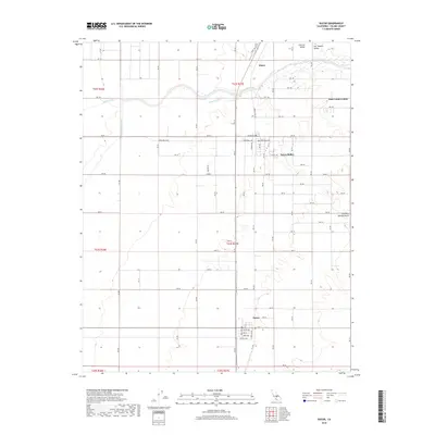
2018 Map of Ducor
USGS Topo · Published 2018About this map
Terra Bella and Ducor anchor this section of the southern San Joaquin Valley, where a meticulously gridded network of roads like Terra Bella Ave and Ave 100 facilitates intensive agriculture. The landscape is defined by its water management systems, notably the Friant-Kern Canal and Deer Cr Ditch, which redirect surface water to support the surrounding orchards and fields. While the western half of the map remains largely flat, the eastern edge begins to rise toward Fountain Springs Gulch, signaling the transition from the valley floor to the Sierra Nevada foothills. Smaller clusters like Elmco and the Deer Creek Colony reflect the localized settlement patterns of Tulare County. The intricate survey lines, including t23s r27e, provide a clear view of the township and range system that organized this productive rural corridor during the late 2010s.
Find a feature on this map
73 named features on this map. Tap any name to fly to it.
Don’t see what you’re looking for? This feature index may not catch every label — zoom into the map to look around manually.
Map Details
Editions of this 2018 Ducor Map
This is the sole edition of this map. No revisions or reprints were ever made.
Other maps of this area

1904 · Kaweah
USGS Topo · 1:125,000

1909 · Kaweah
USGS Topo · 1:125,000

1926 · Quincy School
USGS Topo · 1:31,680

1928 · Woodville
USGS Topo · 1:31,680

1929 · Delano
USGS Topo · 1:31,680

1929 · Sausalito School
USGS Topo · 1:31,680

1929 · Richgrove
USGS Topo · 1:31,680

1929 · Porterville
USGS Topo · 1:31,680

1929 · Quincy School
USGS Topo · 1:31,680

1929 · Ducor
USGS Topo · 1:31,680