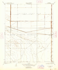
1936 Map of Dudley Ridge
USGS Topo · Published 1947About this map
The Tulare Lake Bed dominates the northern landscape of this Kings County survey, revealing the reclamation efforts and agricultural engineering required to manage this once-vast inland sea. The terrain is defined by a sophisticated network of water management features, including the Cohn Levee and Wilbur Levee, which separate the former lake bottom from rising topography to the south. Along the eastern edge, the West Side Ditch and Side Ditch run parallel to the township lines, facilitating the irrigation of large agricultural holdings like Liberty Farms. Settlement in this era is sparse and functional, anchored by Houser Camp near the ditch works. Rising from the flats, the distinct contours of Dudley Ridge provide a topographical contrast to the leveled fields, illustrating the boundary between the reclaimed lake basin and the higher ground of the San Joaquin Valley.
Find a feature on this map
11 named features on this map. Tap any name to fly to it.
Don’t see what you’re looking for? This feature index may not catch every label — zoom into the map to look around manually.
Map Details
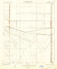
Editions of this 1936 Dudley Ridge Map
2 editions found
Other maps of this area

1914 · Lost Hills
USGS Topo · 1:125,000

1930 · Avenal Gap
USGS Topo · 1:31,680

1930 · Middle Dome
USGS Topo · 1:31,680

1931 · Harvester
USGS Topo · 1:31,680

1932 · El Rico Ranch
USGS Topo · 1:31,680

1932 · Dudley Ridge
USGS Topo · 1:31,680

1932 · West Camp
USGS Topo · 1:31,680

1932 · Lone Tree Well
USGS Topo · 1:31,680

1933 · Avenal Gap
USGS Topo · 1:31,680

1933 · Kettleman City
USGS Topo · 1:31,680