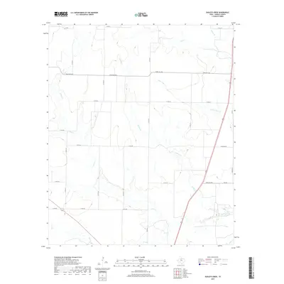
2019 Map of Dudleys Creek
USGS Topo · Published 2019About this map
Dudleys Cr winds through this rural section of Haskell County, defining a landscape dominated by seasonal drainage and a grid of local ranch roads. The terrain is a network of creek beds including Paint Cr, Willow Cr, and Little Timber Cr, which converge and diverge across open acreage. This 2019 survey documents the modern layout of agricultural and pastoral lands, where infrastructure is primarily composed of long-established routes like Ranch Rd 1225 and Ranch Rd 618. The drainage patterns, featuring smaller tributaries such as Mule Cr and the descriptively named Stink Cr, dictate the placement of properties and crossings. This map provides a clear view of the sparse but vital roadway system, including W Overton Rd and Co Rd 440, essential for navigating this expanse of the Texas rolling plains.
Find a feature on this map
31 named features on this map. Tap any name to fly to it.
Don’t see what you’re looking for? This feature index may not catch every label — zoom into the map to look around manually.
Map Details
Editions of this 2019 Dudleys Creek Map
This is the sole edition of this map. No revisions or reprints were ever made.
Other maps of this area

1891 · Anson
USGS Topo · 1:125,000

1893 · Anson
USGS Topo · 1:125,000

1925 · Haskell 3-b
USGS Topo · 1:48,000

1954 · Abilene
USGS Topo · 1:250,000

1954 · Wichita Falls
USGS Topo · 1:250,000

1958 · Wichita Falls
USGS Topo · 1:250,000

1958 · Abilene
USGS Topo · 1:250,000

1964 · Sagerton
USGS Topo · 1:24,000

1965 · Tuxedo
USGS Topo · 1:24,000

1965 · Lueders NW
USGS Topo · 1:24,000