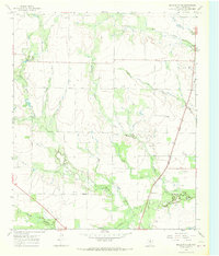
1966 Map of Dudleys Creek
USGS Topo · Published 1969About this map
Plainview serves as a central landmark in this mid-1960s survey of the Texas Rolling Plains, illustrating the rural settlement patterns of Haskell County. The landscape is defined by an intricate drainage system including Dudleys Creek, Paint Creek, and Willow Creek, which cross the terrain toward larger basins. Transportation and energy infrastructure are prominent, with the Fort Worth and Denver railroad cutting through the eastern portion of the sheet alongside several major pipelines. Petroleum exploration is evident through the numerous oil wells scattered across the plains, while a Roadside Park along the highway provides a rare public point of interest. This topographical study captures the intersection of traditional cattle or farming land with the industrial expansion of the mid-20th-century Texas oil economy.
Find a feature on this map
15 named features on this map. Tap any name to fly to it.
Don’t see what you’re looking for? This feature index may not catch every label — zoom into the map to look around manually.
Map Details
Editions of this 1966 Dudleys Creek Map
This is the sole edition of this map. No revisions or reprints were ever made.
Other maps of this area

1891 · Anson
USGS Topo · 1:125,000

1893 · Anson
USGS Topo · 1:125,000

1925 · Haskell 3-b
USGS Topo · 1:48,000

1954 · Abilene
USGS Topo · 1:250,000

1954 · Wichita Falls
USGS Topo · 1:250,000

1958 · Wichita Falls
USGS Topo · 1:250,000

1958 · Abilene
USGS Topo · 1:250,000

1964 · Sagerton
USGS Topo · 1:24,000

1965 · Tuxedo
USGS Topo · 1:24,000

1965 · Lueders NW
USGS Topo · 1:24,000