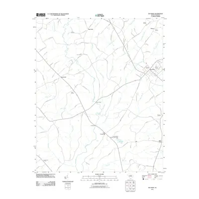
2011 Map of Due West
USGS Topo · Published 2011About this map
Due West serves as the focal point of this Abbeville County landscape, where the educational and residential core is surrounded by a network of rural settlements and family cemeteries. The terrain is defined by the branching tributaries of the Little River, including Chickasaw Creek and Hogskin Creek, which shaped early land boundaries and transport routes. Evidence of established local lineages is visible in the numerous burial grounds scattered across the countryside, such as the Ashley Cemetery near Level Land and the McClain Cemetery in the north. Practical river crossings like Tucker Bridge and Fairs Bridge connect the outlying communities of West View and Fairs Crossroads to the town center. The presence of L R Powell Lake and the South Carolina Noname 01003 D-3037 Dam reflects the mid-century water management efforts that supplemented the natural flow of Park Creek and Johnson Creek.
Find a feature on this map
96 named features on this map. Tap any name to fly to it.
Don’t see what you’re looking for? This feature index may not catch every label — zoom into the map to look around manually.
Map Details
Editions of this 2011 Due West Map
This is the sole edition of this map. No revisions or reprints were ever made.
Other maps of this area

1892 · Abbeville
USGS Topo · 1:125,000

1893 · Elberton
USGS Topo · 1:125,000

1948 · Abbeville East
USGS Topo · 1:24,000

1948 · Abbeville West
USGS Topo · 1:24,000

1949 · Abbeville
USGS Topo · 1:24,000

1950 · Abbeville East
USGS Topo · 1:24,000

1954 · Greenville
USGS Topo · 1:250,000

1958 · Greenville
USGS Topo · 1:250,000

1964 · Antreville
USGS Topo · 1:24,000

1964 · Saylors Crossroads
USGS Topo · 1:24,000