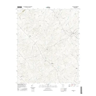
2017 Map of Due West
USGS Topo · Published 2017About this map
Due West serves as a primary settlement node in this Upstate South Carolina landscape, where the rural character of Abbeville County is defined by its dense network of family-named cemeteries and creek crossings. The terrain is deeply etched by the Little River and its numerous tributaries, including Chickasaw Cr and Hogskin Cr, which dictated the early placement of crossings like Tucker Bridge and Fairs Bridge. Local history is preserved in the numerous burial grounds scattered across the countryside, from the Winona Cem in the northeast to the Little Mountain Cem in the southwest. The presence of crossroads communities like Level Land and Fairs Crossroads indicates a long-standing agricultural pattern, where commerce and social life centered on key intersections and the mills that once lined the banks of Blacks Mill Rd. This 2017 survey documents the modern road network while preserving these traditional place names.
Find a feature on this map
89 named features on this map. Tap any name to fly to it.
Don’t see what you’re looking for? This feature index may not catch every label — zoom into the map to look around manually.
Map Details
Editions of this 2017 Due West Map
This is the sole edition of this map. No revisions or reprints were ever made.
Other maps of this area

1892 · Abbeville
USGS Topo · 1:125,000

1893 · Elberton
USGS Topo · 1:125,000

1948 · Abbeville East
USGS Topo · 1:24,000

1948 · Abbeville West
USGS Topo · 1:24,000

1949 · Abbeville
USGS Topo · 1:24,000

1950 · Abbeville East
USGS Topo · 1:24,000

1954 · Greenville
USGS Topo · 1:250,000

1958 · Greenville
USGS Topo · 1:250,000

1964 · Antreville
USGS Topo · 1:24,000

1964 · Saylors Crossroads
USGS Topo · 1:24,000