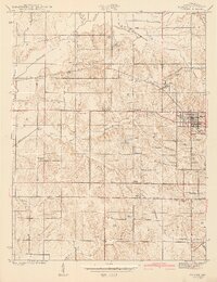
1943 Map of Dugger
USGS Topo · Published 1943About this map
The town of Dugger serves as a focal point for this 1940s landscape, where a dense network of extraction and transportation shaped local life. Numerous excavations, including the Hickory Grove Mine and several scattered Strip Mines, dominate the topography, while a series of rail lines including the Pennsylvania and Chicago Indianapolis and Louisville converge to support the local coal economy. This industrial activity is woven among long-established rural settlements like Caledonia, Farnsworth, and Scotchtown.
Find a feature on this map
43 named features on this map. Tap any name to fly to it.
Don’t see what you’re looking for? This feature index may not catch every label — zoom into the map to look around manually.
Map Details
Editions of this 1943 Dugger Map
2 editions found
Other maps of this area
1940 · Linton
USGS Topo · 1:24,000
1940 · Jasonville
USGS Topo · 1:24,000
1942 · Shelburn
USGS Topo · 1:24,000
1943 · Hymera
USGS Topo · 1:24,000
1943 · Carlisle
USGS Topo · 1:24,000
1943 · Sandborn
USGS Topo · 1:24,000
1943 · Sullivan
USGS Topo · 1:24,000
1944 · Bucktown
USGS Topo · 1:24,000
1947 · Linton
USGS Topo · 1:24,000
1952 · Dugger
USGS Topo · 1:24,000