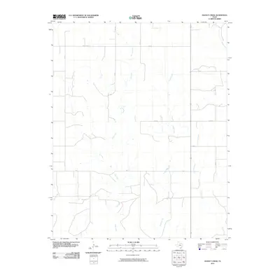
2010 Map of Dugout Creek
USGS Topo · Published 2010About this map
Dugout Creek and its neighboring tributaries define this corner of Lipscomb County, where the High Plains landscape is etched by a series of north-flowing watercourses. The 2010 survey reveals a highly organized grid of rural infrastructure, including secondary routes like Uncle Sam Rd and Fm 2172 that follow the section lines of the Texas Panhandle. The drainages of Fifth Creek, Chicken Creek, and Skunk Creek create a dendritic pattern across the terrain, converging as they move northward. This map documents the essential geography of the area's ranching and agricultural economy, anchored by the persistent path of the local creek systems and a road network that includes named segments like Duke.
Find a feature on this map
15 named features on this map. Tap any name to fly to it.
Don’t see what you’re looking for? This feature index may not catch every label — zoom into the map to look around manually.
Map Details
Editions of this 2010 Dugout Creek Map
This is the sole edition of this map. No revisions or reprints were ever made.
Other maps of this area

1954 · Perryton
USGS Topo · 1:250,000

1958 · Perryton
USGS Topo · 1:250,000

1972 · Barton Corners
USGS Topo · 1:24,000

1972 · Dugout Creek
USGS Topo · 1:24,000

1972 · Skunk Creek
USGS Topo · 1:24,000

1972 · Follett
USGS Topo · 1:24,000

1972 · Willow Creek
USGS Topo · 1:24,000

1972 · Lipscomb
USGS Topo · 1:24,000

1972 · Darrouzett
USGS Topo · 1:24,000

1972 · Gaylord
USGS Topo · 1:24,000