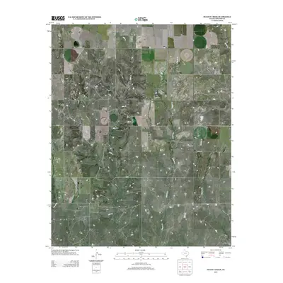
2012 Map of Dugout Creek
USGS Topo · Published 2012About this map
Dugout Cr and its various tributaries define the drainage of this Lipscomb County ranching landscape, characterized by a grid of rural roads and scattered cattle tank developments. The map shows the branching paths of Fifth Cr, Chicken Cr, and Fourth Cr, which create localized relief in an otherwise expansive plateau. Notable local landmarks and named road segments like Uncle Sam, Duke, and the northern reach of Ranch Road 2172 provide specific reference points for researchers of the northeast Texas Panhandle. The absence of concentrated settlements highlights the area's enduring reliance on large-scale agriculture and ranching operations, with the landscape segmented by county roads such as Co Rd 14 and Co Rd N.
Find a feature on this map
15 named features on this map. Tap any name to fly to it.
Don’t see what you’re looking for? This feature index may not catch every label — zoom into the map to look around manually.
Map Details
Editions of this 2012 Dugout Creek Map
This is the sole edition of this map. No revisions or reprints were ever made.
Other maps of this area

1954 · Perryton
USGS Topo · 1:250,000

1958 · Perryton
USGS Topo · 1:250,000

1972 · Barton Corners
USGS Topo · 1:24,000

1972 · Dugout Creek
USGS Topo · 1:24,000

1972 · Skunk Creek
USGS Topo · 1:24,000

1972 · Follett
USGS Topo · 1:24,000

1972 · Willow Creek
USGS Topo · 1:24,000

1972 · Lipscomb
USGS Topo · 1:24,000

1972 · Darrouzett
USGS Topo · 1:24,000

1972 · Gaylord
USGS Topo · 1:24,000