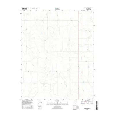
2016 Map of Dugout Creek
USGS Topo · Published 2016About this map
Duke stands at the heart of this North Texas landscape, where the High Plains are deeply dissected by a network of seasonal drainages. The topography is defined by the winding courses of Fifth Cr and Dugout Cr, which carve intricate patterns through the terrain as they flow toward the south and east. This 2016 survey illustrates a rural environment shaped by the regular grid of county roads, including Uncle Sam Rd and various numbered routes like Co Rd 11 and Co Rd N. The map captures the agricultural and ranching character of Lipscomb County, showing how modern transportation routes like Fm 2172 follow the high ground between the creek beds of Chicken Cr and Skunk Cr.
Find a feature on this map
16 named features on this map. Tap any name to fly to it.
Don’t see what you’re looking for? This feature index may not catch every label — zoom into the map to look around manually.
Map Details
Editions of this 2016 Dugout Creek Map
This is the sole edition of this map. No revisions or reprints were ever made.
Other maps of this area

1954 · Perryton
USGS Topo · 1:250,000

1958 · Perryton
USGS Topo · 1:250,000

1972 · Barton Corners
USGS Topo · 1:24,000

1972 · Dugout Creek
USGS Topo · 1:24,000

1972 · Skunk Creek
USGS Topo · 1:24,000

1972 · Follett
USGS Topo · 1:24,000

1972 · Willow Creek
USGS Topo · 1:24,000

1972 · Lipscomb
USGS Topo · 1:24,000

1972 · Darrouzett
USGS Topo · 1:24,000

1972 · Gaylord
USGS Topo · 1:24,000