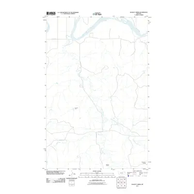
2011 Map of Dugout Creek
USGS Topo · Published 2011About this map
The Missouri River carves the northern edge of this high-plains landscape, defining a region where water management and drainage patterns dictate the rhythm of the land. This survey from 2011 captures a network of ephemeral and perennial waterways, most notably the winding course of Hardscrabble Creek and its tributary, East Hardscrabble Creek. These drainage systems have etched distinct landforms like Garden Coulee and Goodman Coulee into the prairie, illustrating the long-term erosion patterns of the Missouri River basin.
Find a feature on this map
10 named features on this map. Tap any name to fly to it.
Don’t see what you’re looking for? This feature index may not catch every label — zoom into the map to look around manually.
Map Details
Editions of this 2011 Dugout Creek Map
This is the sole edition of this map. No revisions or reprints were ever made.
Other maps of this area

1909 · Glendive
USGS Topo · 1:250,000

1948 · Fort Kipp
USGS Topo · 1:24,000

1949 · Fort Kipp
USGS Topo · 1:24,000

1954 · Glendive
USGS Topo · 1:250,000

1954 · Wolf Point
USGS Topo · 1:250,000

1957 · Glendive
USGS Topo · 1:250,000

1958 · Wolf Point
USGS Topo · 1:250,000

1958 · Glendive
USGS Topo · 1:250,000
1969 · Culbertson
USGS Topo · 1:24,000
1969 · Twomile Creek
USGS Topo · 1:24,000