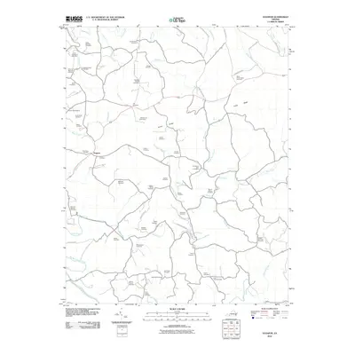
2010 Map of Dugspur
USGS Topo · Published 2010About this map
Dugspur serves as the primary settlement hub for this corner of Carroll County, where the landscape is defined by the high ground of Indian Ridge and a dense network of watercourses including Burks Fork and Mira Fork. The distribution of family-named cemeteries such as the Hattie Marshall Cemetery, Ezra Marshall Cemetery, and Polly Ann Marshall Cemetery indicates a long history of generational land ownership along Greasy Creek and its tributaries. A notable institutional landmark, the State Prison Camp Number 5, sits north of Indian Ridge, providing a contrast to the surrounding rural character. This map is particularly valuable for genealogists, as it documents dozens of small burial grounds, from the Mitchell Chapel Cemetery to the Vince Largen Cemetery, many tucked away on secondary routes like Indian Valley Rd and Kanawha Ridge Rd.
Find a feature on this map
69 named features on this map. Tap any name to fly to it.
Don’t see what you’re looking for? This feature index may not catch every label — zoom into the map to look around manually.
Map Details
Editions of this 2010 Dugspur Map
This is the sole edition of this map. No revisions or reprints were ever made.
Other maps of this area

1889 · Hillsville
USGS Topo · 1:125,000

1892 · Hillsville
USGS Topo · 1:125,000

1896 · Hillsville
USGS Topo · 1:125,000

1928 · Stuart
USGS Topo · 1:48,000

1931 · Stuart
USGS Topo · 1:62,500

1953 · Winston-Salem
USGS Topo · 1:250,000

1955 · Winston-Salem
USGS Topo · 1:250,000

1956 · Macks Mountain
USGS Topo · 1:62,500

1957 · Mount Airy
USGS Topo · 1:62,500

1957 · Floyd
USGS Topo · 1:62,500