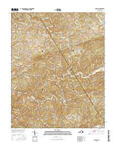
2016 Map of Dugspur
USGS Topo · Published 2016About this map
The community of Dugspur sits amidst the drainage network of the Blue Ridge, where the boundaries of Floyd Co and Carroll Co meet. The landscape is defined by an exceptional density of family burial grounds, reflecting generations of kinship and local history. Named cemeteries such as the Hattie Marshall Cem, Ezra Marshall Cem, and Polly Ann Marshall Cem are clustered in the northern hills, while others like Mitchell Chapel Cem and Mount Hebron Cem suggest the spiritual centers of these mountain neighborhoods.
Find a feature on this map
123 named features on this map. Tap any name to fly to it.
Don’t see what you’re looking for? This feature index may not catch every label — zoom into the map to look around manually.
Map Details
Editions of this 2016 Dugspur Map
This is the sole edition of this map. No revisions or reprints were ever made.
Other maps of this area

1889 · Hillsville
USGS Topo · 1:125,000

1892 · Hillsville
USGS Topo · 1:125,000

1896 · Hillsville
USGS Topo · 1:125,000

1928 · Stuart
USGS Topo · 1:48,000

1931 · Stuart
USGS Topo · 1:62,500

1953 · Winston-Salem
USGS Topo · 1:250,000

1955 · Winston-Salem
USGS Topo · 1:250,000

1956 · Macks Mountain
USGS Topo · 1:62,500

1957 · Mount Airy
USGS Topo · 1:62,500

1957 · Floyd
USGS Topo · 1:62,500