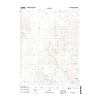
2014 Map of Dugway Range SW
USGS Topo · Published 2014About this map
Spor Mtn rises as a prominent landmark in this arid portion of Juab County, surrounded by a complex network of industrial and historic routes. The northern edge of the map is defined by the historic Pony Exp trail, which traverses the open expanse of Fish Springs Flat before entering the high ground near Thomas Ridge. This landscape is characterized by its isolation and specialized access, evidenced by a series of named roads such as Lost Sheep, Oversight Rd, and Flourspar. These routes suggest a history of resource extraction and range management, connecting the high peaks to water sources like Wildhorse Spring and Hangrock Spring. The terrain transitions from the broken elevations of the Black Rock Hills and Goshoot Canyon into the deeply incised drainages of the North Fork Pismire Wash and South Fork Pismire Wash.
Find a feature on this map
25 named features on this map. Tap any name to fly to it.
Don’t see what you’re looking for? This feature index may not catch every label — zoom into the map to look around manually.
Map Details
Editions of this 2014 Dugway Range SW Map
This is the sole edition of this map. No revisions or reprints were ever made.
Other maps of this area

1908 · Fish Springs
USGS Topo · 1:250,000

1910 · Fish Springs
USGS Topo · 1:250,000

1953 · Dugway Range NE
USGS Topo · 1:24,000

1953 · Dugway Pass
USGS Topo · 1:24,000

1953 · Dugway Range
USGS Topo · 1:62,500

1953 · Topaz Mtn
USGS Topo · 1:62,500

1953 · Dugway Range NW
USGS Topo · 1:24,000

1953 · Delta
USGS Topo · 1:250,000

1958 · Delta
USGS Topo · 1:250,000

1962 · Delta
USGS Topo · 1:250,000