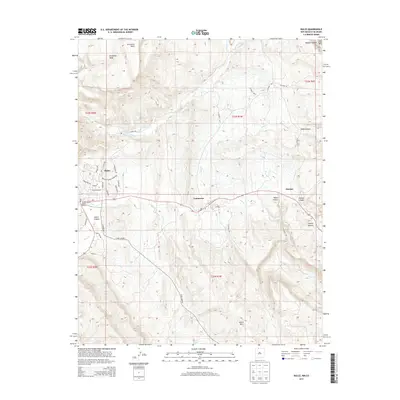
2013 Map of Dulce
USGS Topo · Published 2013About this map
Dulce and the surrounding high-desert plateau of Rio Arriba County are documented here in this 2013 survey, which highlights the intersection of tribal land and rural settlement. The Jicarilla Apache Historic District sits at the heart of the community, while the landscape is defined by the canyon systems of the Navajo River and Amargo Cr. The topography transitions from the broad summit of Archuleta Mesa in the north down toward the community of Lumberton and the small settlement at Amargo. This area reflects a reliance on the sparse water sources of the region, as seen at Dulce Pond. Researchers will find a mix of modern infrastructure and legacy naming, such as Cemetery Rd and the family-associated routes around the Dulce Canyon area, providing a clear look at the spatial layout of the Jicarilla Apache Reservation and its neighboring towns.
Find a feature on this map
43 named features on this map. Tap any name to fly to it.
Don’t see what you’re looking for? This feature index may not catch every label — zoom into the map to look around manually.
Map Details
Editions of this 2013 Dulce Map
This is the sole edition of this map. No revisions or reprints were ever made.
Other maps of this area

1889 · Largo
USGS Topo · 1:250,000

1895 · Largo
USGS Topo · 1:250,000

1913 · Summitville
USGS Topo · 1:125,000

1915 · Summitville
USGS Topo · 1:125,000

1924 · Pagosa Springs
USGS Topo · 1:125,000

1927 · Pagosa Springs
USGS Topo · 1:125,000

1945 · Durango
USGS Topo · 1:250,000

1953 · Durango
USGS Topo · 1:250,000

1954 · Durango
USGS Topo · 1:250,000

1954 · Aztec
USGS Topo · 1:250,000