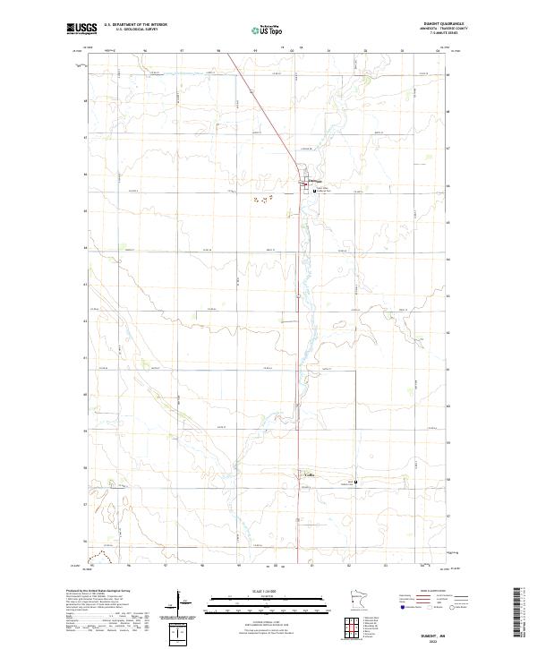
2022 Map of Dumont
USGS Topo · Published 2022About this map
The agrarian plains of Traverse County define this modern survey, where the small settlement of Dumont serves as a local hub at the intersection of Co Hwy 6 and US Highway 75. The landscape is primarily organized by the Public Land Survey System, with a precise grid of roads like 710th Ave and Co Rd 70 cutting through fertile farm sections. Hydrology in the region is shaped by the winding West Branch Twelvemile Creek and human-engineered water management features such as County Ditch Number Fifteen. To the south, the community of Collis stands near Saint Patrick Cem, while Saint Johns Lutheran Cem provides a genealogical touchpoint on the outskirts of Dumont. The map reflects a deeply rooted agricultural economy where drainage and road access are paramount to the local way of life.
Find a feature on this map
34 named features on this map. Tap any name to fly to it.
Don’t see what you’re looking for? This feature index may not catch every label — zoom into the map to look around manually.
Map Details
Editions of this 2022 Dumont Map
This is the sole edition of this map. No revisions or reprints were ever made.
Other maps of this area

1915 · White Rock
USGS Topo · 1:62,500

1916 · Beardsley
USGS Topo · 1:62,500

1918 · White Rock
USGS Topo · 1:62,500

1918 · Beardsley
USGS Topo · 1:62,500

1950 · Graceville
USGS Topo · 1:62,500

1951 · Wheaton
USGS Topo · 1:62,500

1953 · Milbank
USGS Topo · 1:250,000

1958 · Milbank
USGS Topo · 1:250,000
1972 · Wheaton West
USGS Topo · 1:24,000
1974 · Graceville NE
USGS Topo · 1:24,000