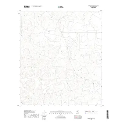
2019 Map of Dunbar Draw NE
USGS Topo · Published 2019About this map
Dunbar Draw carves through the central portion of this Sutton County landscape, defining the local drainage patterns typical of the Edwards Plateau. The terrain is characterized by a dense network of intermittent watercourses, including Cusenbury Draw in the southwestern corner, which together shape the undulating topography. This 2019 survey documents a rural environment primarily organized around private ranch access and long-distance connectivity. Ranch roads and utility routes, such as Bond Rd and several private lanes like Pvt Rd 3310 and Pvt Rd 3342, navigate the ridgelines and valleys. The presence of San Angelo St suggests a historical or planned connection toward regional hubs, while the lack of dense settlement indicates the persistence of large-scale land holdings and traditional West Texas ranching operations into the early twenty-first century.
Find a feature on this map
8 named features on this map. Tap any name to fly to it.
Don’t see what you’re looking for? This feature index may not catch every label — zoom into the map to look around manually.
Map Details
Editions of this 2019 Dunbar Draw NE Map
This is the sole edition of this map. No revisions or reprints were ever made.
Other maps of this area

1893 · Rock Springs
USGS Topo · 1:125,000

1893 · Fort McKavett
USGS Topo · 1:125,000

1954 · Sonora
USGS Topo · 1:250,000

1958 · Sonora
USGS Topo · 1:250,000

1963 · Steen Lake
USGS Topo · 1:24,000

1963 · Harrison Ranch
USGS Topo · 1:24,000

1963 · Buffalo Well SW
USGS Topo · 1:24,000

1964 · Sonora
USGS Topo · 1:24,000

1964 · Sonora SE
USGS Topo · 1:24,000

1967 · Dunbar Draw SW
USGS Topo · 1:24,000