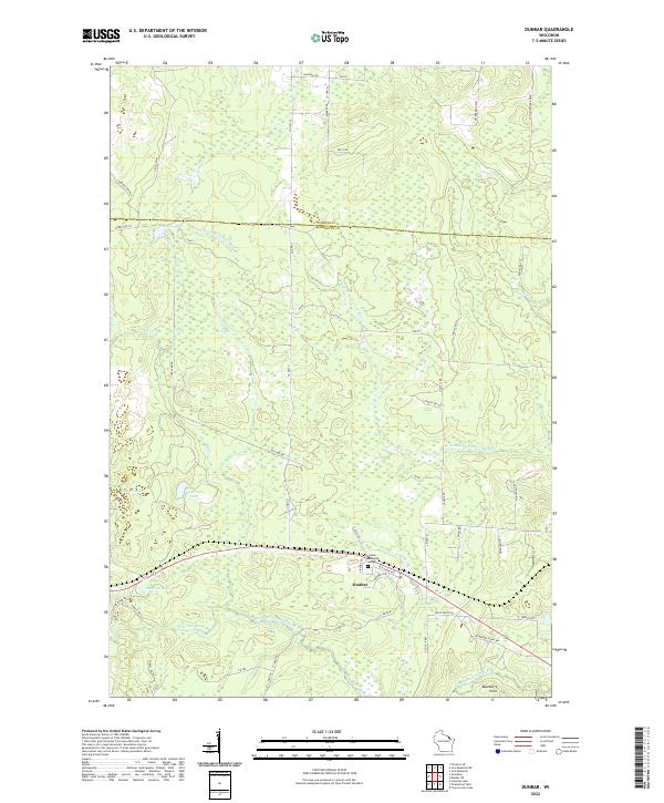
2022 Map of Dunbar
USGS Topo · Published 2022About this map
Dunbar serves as the primary community hub in this northern Wisconsin landscape, situated along the southern edge of the Florence and Marinette County line. The terrain is defined by an intricate network of waterways, including the S Br Little Popple River in the north and the North Branch Pike River and S Br Pemebonwon River to the south. Numerous small lakes such as Pothole Lake, Sackerson Lake, and Dvorak Lake are scattered throughout the forested tracts, indicating a glacial topography rich in wetlands.
Find a feature on this map
57 named features on this map. Tap any name to fly to it.
Don’t see what you’re looking for? This feature index may not catch every label — zoom into the map to look around manually.
Map Details
Editions of this 2022 Dunbar Map
This is the sole edition of this map. No revisions or reprints were ever made.
Other maps of this area

1939 · Dunbar
USGS Topo · 1:48,000

1939 · Goodman
USGS Topo · 1:48,000

1939 · Iron Mountain
USGS Topo · 1:48,000

1941 · Florence
USGS Topo · 1:48,000

1941 · Dunbar
USGS Topo · 1:48,000

1941 · Iron Mountain
USGS Topo · 1:48,000

1946 · Goodman
USGS Topo · 1:48,000

1947 · Dunbar
USGS Topo · 1:48,000

1947 · Iron Mountain
USGS Topo · 1:48,000

1954 · Iron Mountain
USGS Topo · 1:250,000