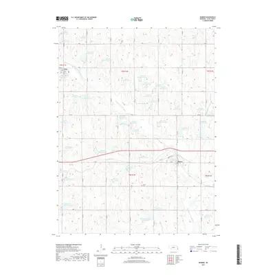
2017 Map of Dunbar
USGS Topo · Published 2017About this map
Dunbar and Otoe anchor this portion of Otoe County, where the agricultural landscape is defined by an extensive network of water management features. The N Fork Little Nemaha River winds through the central terrain, fed by a dense concentration of small impoundments such as Wilson Cr Reservoir 12-3, Wilson Cr Reservoir 2-2, and Brownell Cr Reservoir 1-1. These reservoirs, often named numerically or with simple letter designations, reflect the systematic approach to soil and water conservation in this prairie region. Genealogists and local researchers can locate the Union Cem in the north and the Dunbar Cem south of the village, both situated near established section-line roads. The town of Dunbar itself sits at a junction where Oakview Dr meets the larger regional corridors, serving as a hub for the surrounding farmsteads linked by the grid of named routes like Co Rd 46 and H Rd.
Find a feature on this map
73 named features on this map. Tap any name to fly to it.
Don’t see what you’re looking for? This feature index may not catch every label — zoom into the map to look around manually.
Map Details
Editions of this 2017 Dunbar Map
This is the sole edition of this map. No revisions or reprints were ever made.
Other maps of this area

1903 · Weeping Water
USGS Topo · 1:125,000

1907 · Nebraska City
USGS Topo · 1:62,500

1929 · Weeping Water
USGS Topo · 1:125,000

1935 · Nehawka
USGS Topo · 1:48,000

1940 · Nehawka
USGS Topo · 1:62,500

1955 · Nebraska City
USGS Topo · 1:250,000

1955 · Lincoln
USGS Topo · 1:250,000

1957 · Nebraska City
USGS Topo · 1:250,000

1957 · Lincoln
USGS Topo · 1:250,000

1958 · Lincoln
USGS Topo · 1:250,000