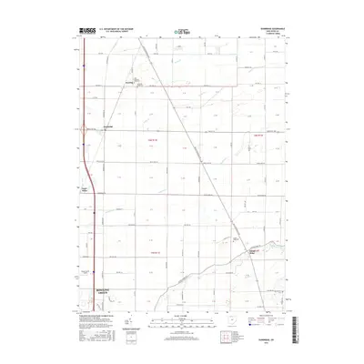
2016 Map of Dunbridge
USGS Topo · Published 2016About this map
The city of Bowling Green anchors the southwestern corner of this Wood County landscape, where the flat agricultural plains of Northwest Ohio are defined by a rigid grid of township roads and drainage systems. This 2016 survey illustrates the persistent rural character of the area, punctuated by small unincorporated settlements such as Dowling, Dunbridge, and Sugar Ridge. The importance of local heritage is evident in the cluster of burial grounds including New Belleville Ridge Cem, Belleville Ridge Cem, and Scotch Ridge Cem, which serve as vital landmarks for genealogists and local historians tracing families in this part of the state. Waterways like Toussaint Cr and the N Br Portage River meander across the geometric parcels, while the Wood County Airport indicates the modern infrastructure supporting the regional hub at Bowling Green.
Find a feature on this map
66 named features on this map. Tap any name to fly to it.
Don’t see what you’re looking for? This feature index may not catch every label — zoom into the map to look around manually.
Map Details
Editions of this 2016 Dunbridge Map
This is the sole edition of this map. No revisions or reprints were ever made.
Other maps of this area

1900 · Maumee Bay
USGS Topo · 1:62,500

1900 · Toledo
USGS Topo · 1:62,500

1901 · Bowling Green
USGS Topo · 1:62,500

1901 · Elmore
USGS Topo · 1:62,500

1903 · Bowling Green
USGS Topo · 1:62,500

1903 · Elmore
USGS Topo · 1:62,500

1934 · Rossford
USGS Topo · 1:24,000

1935 · Walbridge
USGS Topo · 1:24,000

1935 · Maumee
USGS Topo · 1:24,000

1938 · Walbridge
USGS Topo · 1:31,680