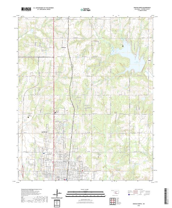
2022 Map of Duncan North
USGS Topo · Published 2022About this map
Marlow and the northern outskirts of Duncan dominate this landscape in Stephens County, where the transition from municipal development to rural Oklahoma acreage is clearly defined. The Stephens County Courthouse stands as a central civic landmark in the southern portion of the sheet, while the city's infrastructure extends to the east at the Duncan Waterworks. The surrounding territory is characterized by a series of small water management projects and natural drainages, including the Rock Cr Site 16 Reservoir and the winding course of Wildhorse Cr.
Find a feature on this map
80 named features on this map. Tap any name to fly to it.
Don’t see what you’re looking for? This feature index may not catch every label — zoom into the map to look around manually.
Map Details
Editions of this 2022 Duncan North Map
This is the sole edition of this map. No revisions or reprints were ever made.
Other maps of this area

1901 · Addington
USGS Topo · 1:125,000

1902 · Rush Springs
USGS Topo · 1:125,000

1949 · Nellie
USGS Topo · 1:62,500

1950 · Marlow
USGS Topo · 1:62,500

1951 · Marlow
USGS Topo · 1:62,500

1955 · Lawton
USGS Topo · 1:250,000
1956 · Denton
USGS Topo · 1:24,000

1956 · Nellie
USGS Topo · 1:24,000

1956 · Nellie
USGS Topo · 1:62,500

1957 · Ardmore
USGS Topo · 1:250,000