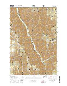
2017 Map of Duncan
USGS Topo · Published 2017About this map
Duncan and Smith Gate sit within the high-elevation landscape of the Umatilla National Forest in Umatilla County. The area is defined by the significant drainage of Meacham Cr, which cuts through a series of prominent landforms including Duncan Canyon and Dutchman Canyon. These waterways, including N Fork Meacham Cr and tributaries like Allen Creek, have carved a complex system of ridges such as Gibbon Ridge, Horse Ridge, and N Fork Ridge. The map details a network of forest development roads, such as Co 911 RD and Nat For Dev RD 010, which provide access to these remote reaches. Notable landmarks for navigation or local history include Black Canyon Butte, Wilbur Mtn, and water sources like Buck Spring and Junction Spring, illustrating how this part of the Blue Mountains has been utilized for both forestry and public land management.
Find a feature on this map
37 named features on this map. Tap any name to fly to it.
Don’t see what you’re looking for? This feature index may not catch every label — zoom into the map to look around manually.
Map Details
Editions of this 2017 Duncan Map
This is the sole edition of this map. No revisions or reprints were ever made.
Other maps of this area

1953 · Pendleton
USGS Topo · 1:250,000

1956 · Pendleton
USGS Topo · 1:250,000

1963 · Meacham Lake
USGS Topo · 1:24,000

1963 · Bingham Springs
USGS Topo · 1:24,000

1964 · Thorn Hollow
USGS Topo · 1:24,000

1964 · Duncan
USGS Topo · 1:24,000

1964 · Thimbleberry Mtn
USGS Topo · 1:24,000

1964 · Gibbon
USGS Topo · 1:24,000

1964 · Huron
USGS Topo · 1:24,000

1964 · Drumhill Ridge
USGS Topo · 1:24,000