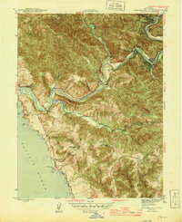
1945 Map of Duncans Mills
USGS Topo · Published 1945About this map
The Russian River carves a deep, winding path toward the Pacific Ocean in this 1945 record of the Sonoma coast. Settlements like Duncans Mills and Monte Rio serve as focal points along the riverbanks, while the surrounding hills are dotted with agricultural and recreational landmarks. The presence of the Sonoma County Boy Scout Camp and Petaluma Boy Scout Camp north of the river highlights the area's mid-century role as a retreat destination.
Find a feature on this map
52 named features on this map. Tap any name to fly to it.
Don’t see what you’re looking for? This feature index may not catch every label — zoom into the map to look around manually.
Map Details
Editions of this 1945 Duncans Mills Map
2 editions found
Other maps of this area

1920 · Healdsburg
USGS Topo · 1:62,500

1921 · Skaggs
USGS Topo · 1:62,500

1933 · Healdsburg
USGS Topo · 1:48,000

1935 · Sebastopol
USGS Topo · 1:48,000

1940 · Healdsburg
USGS Topo · 1:62,500

1942 · Sebastopol
USGS Topo · 1:62,500

1942 · Bodega Head
USGS Topo · 1:24,000

1942 · Arched Rock
USGS Topo · 1:24,000

1943 · Cazadero
USGS Topo · 1:24,000

1943 · Duncans Mills
USGS Topo · 1:24,000