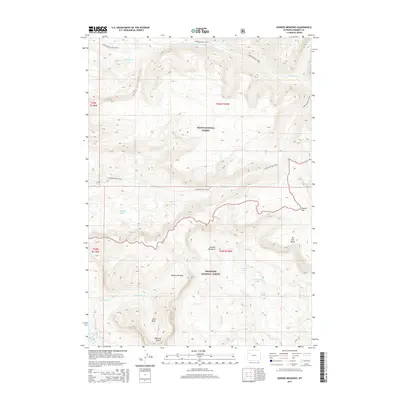
2015 Map of Dundee Meadows
USGS Topo · Published 2015About this map
Dundee Meadows and the surrounding high-elevation basins of the Absaroka Range define this landscape along the continental divide. Situated at the convergence of Teton National Forest and Shoshone National Forest, the region is characterized by a network of drainage systems and glacial features. Water flows through numerous forks and creeks, including the S Buffalo Fork and W Du Noir Cr, while alpine lakes like Mystery Lake and Murray Lake dot the terrain. Significant geologic markers such as Pinnacle Buttes and Du Noir Butte overlook the meadows, while Bonneville Pass provides a navigable route through the mountain peaks. Historical access is documented via the S Fork Buffalo Trail and the Angles Lake Loop Trail, reflecting the enduring reliance on pack trails for traversing these protected wilderness areas.
Find a feature on this map
31 named features on this map. Tap any name to fly to it.
Don’t see what you’re looking for? This feature index may not catch every label — zoom into the map to look around manually.
Map Details
Editions of this 2015 Dundee Meadows Map
This is the sole edition of this map. No revisions or reprints were ever made.
Other maps of this area

1902 · Mt Leidy
USGS Topo · 1:125,000

1905 · Younts Peak
USGS Topo · 1:125,000

1907 · Younts Peak
USGS Topo · 1:125,000

1955 · Driggs
USGS Topo · 1:250,000

1955 · Thermopolis
USGS Topo · 1:250,000

1956 · Esmond Park
USGS Topo · 1:24,000

1956 · Shoshone Pass
USGS Topo · 1:24,000

1956 · Kisinger Lakes
USGS Topo · 1:24,000
1956 · Dundee Meadows
USGS Topo · 1:24,000

1958 · Driggs
USGS Topo · 1:250,000