
1956 Map of Shoshone Pass
USGS Topo · Published 1958About this map
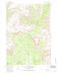
The Continental Divide winds through the high alpine terrain of the Absaroka Range, marking a sharp boundary between the Teton National Forest and Shoshone National Forest. This 1956 field-checked survey reveals a landscape defined by seasonal movement and high-elevation hydrology, centered on the strategic crossing at Shoshone Pass. In the mid-1950s, this area remained largely inaccessible to vehicles, relying instead on an extensive network of pack trails such as the South Fork Shoshone Trail and the Crescent Trail. Notable landmarks like the Stock Cabin near the pass and the towering profile of The Ramshorn served as essential navigational markers for backcountry travel. The presence of the Du Noir Glacier and isolated water bodies like Watkins Lakes underscores the perennial snow and ice that shape the headwaters of the South Fork Shoshone River.
Find a feature on this map
23 named features on this map. Tap any name to fly to it.
Don’t see what you’re looking for? This feature index may not catch every label — zoom into the map to look around manually.
Map Details
Editions of this 1956 Shoshone Pass Map
2 editions found
Other maps of this area

1905 · Younts Peak
USGS Topo · 1:125,000

1907 · Younts Peak
USGS Topo · 1:125,000

1955 · Thermopolis
USGS Topo · 1:250,000

1956 · Esmond Park
USGS Topo · 1:24,000

1956 · Ramshorn Peak
USGS Topo · 1:24,000

1956 · Five Pockets
USGS Topo · 1:24,000

1956 · Kisinger Lakes
USGS Topo · 1:24,000
1956 · Dundee Meadows
USGS Topo · 1:24,000

1958 · Thermopolis
USGS Topo · 1:250,000

1962 · Thermopolis
USGS Topo · 1:250,000