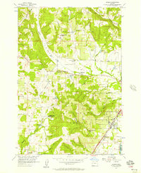
1956 Map of Dundee
USGS Topo · Published 1957About this map
The Red Hills of Dundee define this mid-1950s landscape in Yamhill County, where agriculture and early industry intersect along the Southern Pacific rail line. The Trappist Abbey of Our Lady of Guadalupe occupies a prominent position in the hills west of Dundee, while the Chehalem Valley to the north is dotted with local landmarks like the Ewing Young School and the Ewing Young Historical Marker. This survey illustrates the rural educational network of the era, including the Ribbon Ridge School and the Valley View School (Aband). Evidence of local history and genealogy is abundant through features such as the Noble Cemetery and various quarries. Significant terrain features like Bald Peak in the Chehalem Mountains and water sources like Chehalem Creek and the Millpond reveal the natural topography that shaped the settlement of nearby Lafayette and Sunnycrest.
Find a feature on this map
28 named features on this map. Tap any name to fly to it.
Don’t see what you’re looking for? This feature index may not catch every label — zoom into the map to look around manually.
Map Details
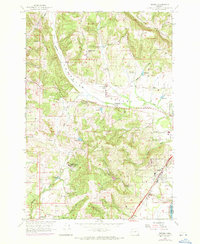
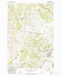
Editions of this 1956 Dundee Map
3 editions found
Other maps of this area

1916 · Tualatin
USGS Topo · 1:62,500

1923 · Mount Angel
USGS Topo · 1:62,500

1924 · Mc Minnville
USGS Topo · 1:48,000

1926 · Mc Minnville
USGS Topo · 1:62,500

1939 · Tualatin
USGS Topo · 1:62,500

1940 · McMinnville
USGS Topo · 1:62,500

1940 · Tualatin
USGS Topo · 1:62,500

1940 · Mount Angel
USGS Topo · 1:62,500

1941 · Yamhill
USGS Topo · 1:62,500

1942 · Yamhill
USGS Topo · 1:62,500