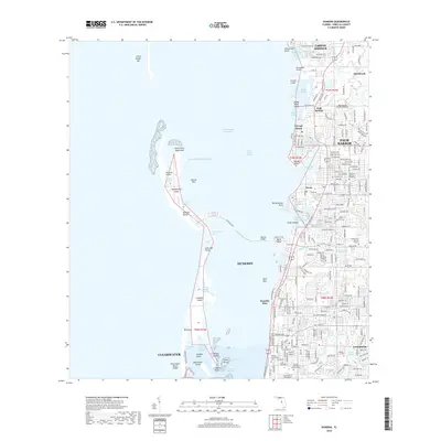
2018 Map of Dunedin
USGS Topo · Published 2018About this map
The barrier islands of Honeymoon Island and Caladesi Island stand against the Gulf of Mexico, separated by the narrow Hurricane Pass. This coastal survey detail highlights the intricate shoreline of northern Pinellas County, where the Intracoastal Waterway threads through Saint Joseph Sound. Inland, the suburban development of Dunedin, Palm Harbor, and Tarpon Springs is punctuated by significant local landmarks including Schiller International University and several large memorial sites like Curlew Hills Memory Gardens and the Dunedin Cemetery. The map reflects a highly developed residential landscape alongside preserved natural features such as Three Rooker Bar and Jerry Lake. Notable hydrological features like Wall Springs and Klosterman Bayou define the transition from the gulf to the mainland, while the Bascule Bridge provides essential connectivity across the sound.
Find a feature on this map
138 named features on this map. Tap any name to fly to it.
Don’t see what you’re looking for? This feature index may not catch every label — zoom into the map to look around manually.
Map Details
Editions of this 2018 Dunedin Map
This is the sole edition of this map. No revisions or reprints were ever made.
Other maps of this area

1921 · Sand Key
USGS Topo · 1:62,500

1921 · St Petersburg
USGS Topo · 1:62,500

1943 · Safety Harbor
USGS Topo · 1:31,680

1943 · Dunedin
USGS Topo · 1:31,680

1943 · Tarpon Springs
USGS Topo · 1:31,680

1943 · Clearwater
USGS Topo · 1:24,000

1943 · Elfers
USGS Topo · 1:24,000

1943 · Oldsmar
USGS Topo · 1:24,000

1944 · Elfers
USGS Topo · 1:31,680

1944 · Oldsmar
USGS Topo · 1:31,680