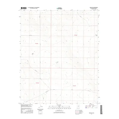
2017 Map of Dunlap NE
USGS Topo · Published 2017About this map
Engleville Cem stands as a solitary landmark in this high-plains landscape of eastern New Mexico, located at the heart of the quadrangle. The terrain is defined by wide drainage systems including Indian Draw in the west and Gillespie Draw in the northeast, which shape the flow of the local watershed across the townships of t1s r22e, t1s r23e, t2s r22e, and t2s r23e. A network of rural county roads, such as White Flat Rd and Gramma Valley Rd, provides access across the open range, following the section lines of the Public Land Survey System. The map documents a sparsely populated ranching environment where the movement of water and the orientation of historic property lines remain the primary geographic features.
Find a feature on this map
16 named features on this map. Tap any name to fly to it.
Don’t see what you’re looking for? This feature index may not catch every label — zoom into the map to look around manually.
Map Details
Editions of this 2017 Dunlap NE Map
This is the sole edition of this map. No revisions or reprints were ever made.
Other maps of this area

1954 · Fort Sumner
USGS Topo · 1:250,000

1958 · Fort Sumner
USGS Topo · 1:250,000

1966 · West Camp
USGS Topo · 1:24,000

1966 · El Morro Mesa
USGS Topo · 1:24,000

1966 · Horney Ranch
USGS Topo · 1:24,000

1967 · Dunlap NE
USGS Topo · 1:24,000

1967 · Conejo Creek West
USGS Topo · 1:24,000

1967 · Devils Well
USGS Topo · 1:24,000
1967 · Lovelady Draw
USGS Topo · 1:24,000
1967 · Dunlap
USGS Topo · 1:24,000