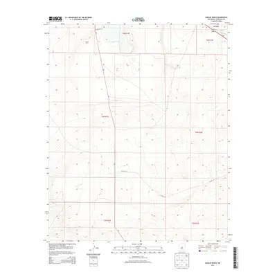
2013 Map of Dunlap Ranch
USGS Topo · Published 2013About this map
Dunlap Ranch sits in the high desert of Torrance County, centered within a landscape defined by the Public Land Survey System’s township and range grid. This 2013 survey by the U.S. Geological Survey illustrates a sparsely populated region where life revolves around isolated ranches and highway transit. The settlement of Carnero appears in the northeast corner, positioned at the intersection of the Us-60 highway and a local railway corridor. This intersection likely served as a primary access point for the region's agricultural interests. The map documents several critical transportation arteries, including NM-3, which bisects the quadrangle from north to south, and local access routes like Co Road C071 and Co Road C072. These roads connect the ranching homesteads to larger markets across the New Mexico plateau, following the natural contours of the undulating terrain.
Find a feature on this map
12 named features on this map. Tap any name to fly to it.
Don’t see what you’re looking for? This feature index may not catch every label — zoom into the map to look around manually.
Map Details
Editions of this 2013 Dunlap Ranch Map
This is the sole edition of this map. No revisions or reprints were ever made.
Other maps of this area

1954 · Fort Sumner
USGS Topo · 1:250,000

1958 · Fort Sumner
USGS Topo · 1:250,000

1978 · Santa Barbara Lake
USGS Topo · 1:24,000

1978 · Tejon
USGS Topo · 1:24,000

1978 · Encino
USGS Topo · 1:24,000

1978 · Negra SE
USGS Topo · 1:24,000

1978 · Negra
USGS Topo · 1:24,000

1978 · Dunlap Ranch
USGS Topo · 1:24,000

1980 · Corona
USGS Topo · 1:100,000
1981 · Duran
USGS Topo · 1:24,000