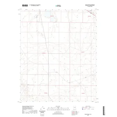
2020 Map of Dunlap Ranch
USGS Topo · Published 2020About this map
Dunlap Ranch and the small settlement of Carnero anchor this high-altitude landscape in Torrance County. The terrain is characterized by the structured grid of the Public Land Survey System, spanning townships including t5n r14e and t4n r15e. Movement through this high-desert environment relies on a network of unpaved tracks and rural connectors such as Canero Rd, Co Rd C034, and Co Rd C067. These routes follow the natural contours of the land, providing access to isolated ranching operations and public lands managed by the BLM. The map captures the quiet, expansive nature of New Mexico's ranching country, where large-scale land divisions and essential water-source access points define the human presence on the land.
Find a feature on this map
11 named features on this map. Tap any name to fly to it.
Don’t see what you’re looking for? This feature index may not catch every label — zoom into the map to look around manually.
Map Details
Editions of this 2020 Dunlap Ranch Map
This is the sole edition of this map. No revisions or reprints were ever made.
Other maps of this area

1954 · Fort Sumner
USGS Topo · 1:250,000

1958 · Fort Sumner
USGS Topo · 1:250,000

1978 · Santa Barbara Lake
USGS Topo · 1:24,000

1978 · Tejon
USGS Topo · 1:24,000

1978 · Encino
USGS Topo · 1:24,000

1978 · Negra SE
USGS Topo · 1:24,000

1978 · Negra
USGS Topo · 1:24,000

1978 · Dunlap Ranch
USGS Topo · 1:24,000

1980 · Corona
USGS Topo · 1:100,000
1981 · Duran
USGS Topo · 1:24,000