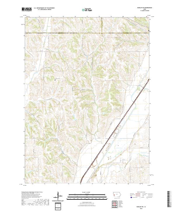
2022 Map of Dunlap SW
USGS Topo · Published 2022About this map
The Boyer River drainage system dominates this section of western Iowa, where the river valley creates a broad corridor for transportation and agriculture. Located in the northern reaches of Harrison County and extending into Monona and Crawford counties, the landscape is defined by the sharp transition between the alluvial plains and the dissected loess hills. The Cleveland Cem stands on a ridge as a quiet reminder of the area's rural settlement history, overlooking a network of tributary streams including Willow Cr and Mud Cr. The township lines of T81N and T82N reveal the systematic surveying that organized this farmland, while the presence of features like Nelson Hollow and Thompson Cr illustrates the deeply carved terrain that characterizes this region. The map captures the persistence of the agrarian grid, connected by local routes such as Panora Ave and Racine Trl.
Find a feature on this map
45 named features on this map. Tap any name to fly to it.
Don’t see what you’re looking for? This feature index may not catch every label — zoom into the map to look around manually.
Map Details
Editions of this 2022 Dunlap SW Map
This is the sole edition of this map. No revisions or reprints were ever made.
Other maps of this area

1954 · Omaha
USGS Topo · 1:250,000

1957 · Omaha
USGS Topo · 1:250,000

1958 · Omaha
USGS Topo · 1:250,000

1970 · Logan
USGS Topo · 1:24,000

1971 · Moorhead SE
USGS Topo · 1:24,000

1971 · Dunlap SW
USGS Topo · 1:24,000

1971 · Dunlap
USGS Topo · 1:24,000
1971 · Moorhead
USGS Topo · 1:24,000
1971 · Dunlap NE
USGS Topo · 1:24,000
1971 · Dunlap NW
USGS Topo · 1:24,000