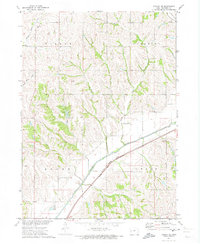
1971 Map of Dunlap NE
USGS Topo · Published 1973About this map
The Boyer River corridor dominates this 1971 survey, serving as the primary artery for transportation and drainage through Crawford County. The Chicago and North Western railroad parallels the river's course, while the C M St P & P line cuts across the northeast corner, illustrating the importance of rail transit to this agricultural landscape. On the higher ground between the river and the northern townships, a series of tributaries including Middle Willow Creek, South Willow Creek, and Welsh Creek carve a series of ridges and valleys. Small-scale local history is preserved in the locations of Township Cem and Dow City Cem, while Nelson Park provides a recreational focal point. This map documents a period of established rural infrastructure just before the further modernization of the Missouri River Basin development program.
Find a feature on this map
15 named features on this map. Tap any name to fly to it.
Don’t see what you’re looking for? This feature index may not catch every label — zoom into the map to look around manually.
Map Details
Editions of this 1971 Dunlap NE Map
This is the sole edition of this map. No revisions or reprints were ever made.
Other maps of this area

1954 · Omaha
USGS Topo · 1:250,000

1954 · Fort Dodge
USGS Topo · 1:250,000

1957 · Omaha
USGS Topo · 1:250,000

1957 · Fort Dodge
USGS Topo · 1:250,000

1958 · Omaha
USGS Topo · 1:250,000

1958 · Fort Dodge
USGS Topo · 1:250,000

1971 · Earling
USGS Topo · 1:24,000

1971 · Ute
USGS Topo · 1:24,000

1971 · Dunlap SW
USGS Topo · 1:24,000

1971 · Dunlap
USGS Topo · 1:24,000