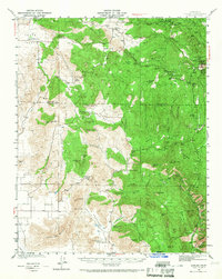
1942 Map of Dunlap
USGS Topo · Published 1967About this map
The foothills of the Sierra Nevada transition from the cattle-ranching floor of Squaw Valley to the heavily forested ridges of the Central California backcountry in this 1940s survey. The map details a scattered network of rural ranching outposts and small mountain settlements like Dunlap and Badger, connected by winding roads that predate modern highway alignments. Family-named holdings such as Baker Ranch, Dixie Ranch, and Roble Lomas Ranch anchor the landscape, suggesting a localized economy tied to timber and grazing.
Find a feature on this map
82 named features on this map. Tap any name to fly to it.
Don’t see what you’re looking for? This feature index may not catch every label — zoom into the map to look around manually.
Map Details
Editions of this 1942 Dunlap Map
2 editions found

Other maps of this area

1903 · Tehipite
USGS Topo · 1:125,000

1904 · Kaweah
USGS Topo · 1:125,000

1905 · Tehipite
USGS Topo · 1:125,000

1909 · Kaweah
USGS Topo · 1:125,000

1921 · Squaw Valley
USGS Topo · 1:31,680

1921 · Stokes Mountain
USGS Topo · 1:24,000

1922 · Trimmer
USGS Topo · 1:96,000

1923 · Sultana
USGS Topo · 1:31,680

1924 · Citrus Cove
USGS Topo · 1:31,680

1924 · Dinuba
USGS Topo · 1:125,000