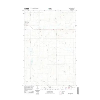
2014 Map of Dunn Center
USGS Topo · Published 2014About this map
Dunn Center anchors the northwest corner of this West River landscape, serving as a hub for the surrounding agricultural plains. The terrain is defined by its subtle drainage patterns, where Spring Cr winds eastward and several significant depressions create wetland habitats such as Boe Slough and Moffet Slough. The straight lines of section roads, including 100th Ave SW and 7th Ave SW, impose a regular grid over the undulating prairie, illustrating the systematic land division of North Dakota's ranching and farming country. To the southeast, the topography rises toward Clay Butte, a distinct high point that provides a natural contrast to the lower-lying sloughs. Highway ND-200 cuts through the center of the sheet, representing the primary east-west corridor for local commerce and travel between small prairie communities.
Find a feature on this map
23 named features on this map. Tap any name to fly to it.
Don’t see what you’re looking for? This feature index may not catch every label — zoom into the map to look around manually.
Map Details
Editions of this 2014 Dunn Center Map
This is the sole edition of this map. No revisions or reprints were ever made.
Other maps of this area

1953 · Watford City
USGS Topo · 1:250,000

1957 · Watford City
USGS Topo · 1:250,000

1967 · Watford City
USGS Topo · 1:250,000

1970 · Dunn Center NW
USGS Topo · 1:24,000

1970 · Halliday NW
USGS Topo · 1:24,000

1970 · Dunn Center NE
USGS Topo · 1:24,000

1973 · Ziner Butte
USGS Topo · 1:24,000

1973 · Dunn Center
USGS Topo · 1:24,000

1973 · Emerson
USGS Topo · 1:24,000

1973 · Werner
USGS Topo · 1:24,000